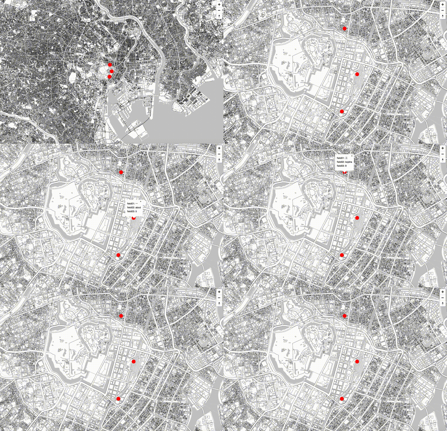
GeoJSONで属性表示するメモ。

script.js
// MIERUNE MONO読み込み
var map = new mapboxgl.Map({
    container: "map",
    style: {
        "version": 8,
        "sources": {
            "MIERUNEMAP": {
                "type": "raster",
                "tiles": ['https://tile.mierune.co.jp/mierune_mono/{z}/{x}/{y}.png'],
                "tileSize": 256
            }
        },
        "layers": [{
            "id": "MIERUNEMAP",
            "type": "raster",
            "source": "MIERUNEMAP",
            "minzoom": 0,
            "maxzoom": 18
        }]
    },
    center: [139.767, 35.681],
    zoom: 11
});

map.on('load', function () {

    // サークル設定
    map.addSource('point_sample', {
        type: 'geojson',
        data: './vector/sample.geojson'
    });

    // スタイル設定
    map.addLayer({
        "id": "point_sample",
        "type": "circle",
        "source": "point_sample",
        "layout": {},
        "paint": {
            'circle-color': "#FF0000",
            'circle-radius': 10
        }
    });

    //ポイントクリックイベント
    map.on('click', 'point_sample', function (e) {
        var coordinates = e.lngLat;
        // 属性設定
        var description =
            'field01: ' + e.features[0].properties.field01 + '<br>' +
            'field02: ' + e.features[0].properties.field02 + '<br>' +
            'field03: ' + e.features[0].properties.field03 ;
        while (Math.abs(e.lngLat.lng - coordinates[0]) > 180) {
            coordinates[0] += e.lngLat.lng > coordinates[0] ? 360 : -360;
        }
        new mapboxgl.Popup()
            .setLngLat(coordinates)
            .setHTML(description)
            .addTo(map);
    });
    // カーソルON,OFF
    map.on('mouseenter', 'point_sample', function () {
        map.getCanvas().style.cursor = 'pointer';
    });
    map.on('mouseleave', 'point_sample', function () {
        map.getCanvas().style.cursor = '';
    });

});

// コントロール関係表示
map.addControl(new mapboxgl.NavigationControl());
Mapbox GL JSを手軽に始めるビルド環境公開しています。
mapboxgljs-starter
- 参考文献
Mapbox GL JS


